Trip Manager: Ralph Carlisle Mobile 0435 460 667
Topic Overview: This two-day road trip will be an exploration of the Upper Brisbane River and Stanley River areas. Themes will include geology, physical geography, aborigines, early European explorers and settlers, pastoral and agricultural activities, forestry, mining and quarrying, the former rail line, flooding and water management, weather prediction.
The general route will be as follows:
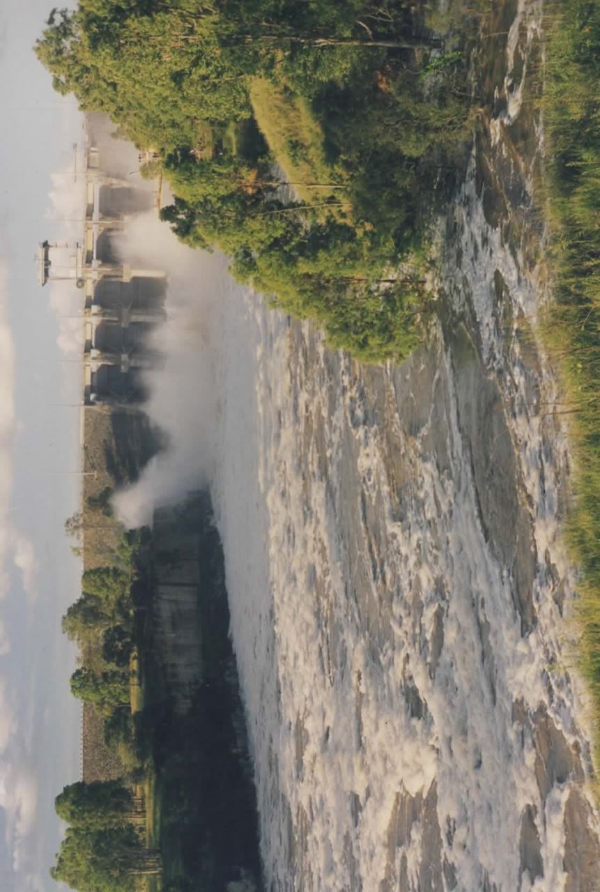
- Day 1: Wivenhoe Dam – Esk - Somerset Dam – Toogoolawah – Moore - Linville
- Day 2: Linville - Mt Stanley - East Branch Rd - return to Linville – Moore - D’Aguilar Highway – Benarkin State Forest - D’Aguilar Highway – Kilcoy – Peachester – Crohamhurst – Mary Cairncross Park - return to Brisbane
It will be a self-drive, tag-along, ‘through’ trip of about 300 km from Lowood to Mary Cairncross Park with an overnight at Linville. Roads are sealed throughout except for unsealed but good roads along the East Branch Road (8 km return unsealed with concrete causeway river crossings) and in Benarkin Forest (4 km return).
It may be cold at night so bring your winter woollies!
Accommodation:
- Fernvale/Wivenhoe (start of trip 8.15 am Thursday 7 October at Wivenhoe Dam, Overflow Common Lookout carpark) - There are three options:
-
- Make an early start from Brisbane that morning or
- Drive from Brisbane on Wednesday afternoon 6 October and:
-
- Camp overnight at Wivenhoe Dam, Logan Inlet campground, or
- Stay overnight at the Fernvale Hotel-Motel or Brisbane Valley Tavern Apartments (both on Main St/ Brisbane Valley Highway, Fernvale) or other accommodation
- Linville (overnight Thursday 7 October) – Two options:
-
- Stay overnight at the Linville Hotel (on the road through Linville) or
- Camp overnight at the Somerset Regional Council camping reserve over the road from the hotel (free, large area, two powered sites, toilets, showers at hotel, no bookings)
Accommodation bookings have been made at the Linville Hotel (5424 7780) for registrants in the originally scheduled trip who wish to take part in the rescheduled trip but remain the participant’s responsibility to finalise and pay for when we get there - no need for action now.
Meals and refreshments will be participant’s responsibility and own expense.
Event Requirements: This event will be conducted in keeping with Health Department Covid-19 directions regarding social distancing, good hygiene practices and group size in force for the venue at the time of the event.
Costs for the two days: RGSQ Members $30 Non-members $50. This covers RGSQ administration costs and daily information handout sheets. If you wish to attend for one day only that is OK although the cost will remain as above.
Limit: 20 participants. Registration on the RGSQ Website required.
Google map of Station Street, Lowood.
https://www.google.com.au/maps/place/Lowood+Showgrounds/@-27.4622335,152.5805333,17z/data=!3m1!4b1!4m5!3m4!1s0x6b96bb2c1b51b4c1:0x38746c4b2c5f44c7!8m2!3d-27.4622335!4d152.582722